Hiking in and around Amsterdam has become one of my favourite outdoor activities for a couple of years now. Getting out of Amsterdam is easy, and there are great hiking trails and walking paths outside of the city to be discovered.
I have no car, which is an advantage in fact. I am actually able to get nicer routes. Especially since I do not have to walk in a large circle in order to return to the same parking eventually. I have found beautiful routes that are easily accessible by public transport, such as train and bus. With this post I would like to share my experiences and what I have discovered so far.
I recommend using the following resources and apps
- OsmAnd app – See the screenshot above. This is by far the best app for following trails. You can load existing trails by selecting the walking map (make sure you have the walking icon on the top left), click on configure the map, and at the bottom you select the menu option
routes. Here you select your favouriteHiking symbol overlayoption and you are all set to discover all sorts of routes. As an addition, you can also upload GPS files when using the routeplanner. The OVinfo app. It shows you the bus station and train stations that are the closest by. It also has a map function. Great for if you’re done with walking and need to get the closest bus-station.
Wandelnet.nl. This is the number 1 website for walking routes and paths in the Netherlands. Check this map for available routes in and around Amsterdam.
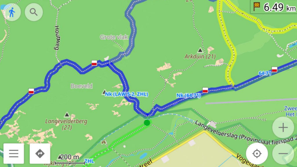
Route 1. From Overveen-Haarlem to Santpoort
I live close by Amsterdam Sloterdijk station, and from there I take the train to Haarlem or to Overveen. I take the train back from Santpoort Noord or Santpoort Zuid station (notice, this is not Zandvoort!). At Haarlem starts a long-distance trail called Nederlandse Kustroute. This in fact is a much longer trail that starts in Zeeland and ends in Den Helder. The route is cut in daily routes around 20km. Easily to be done in 4-5 hours or more if you take it easy.
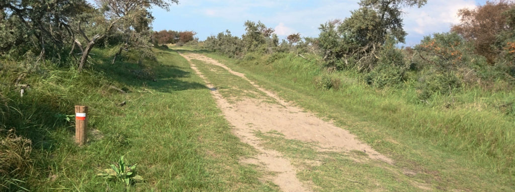
Following the route is very simple. There are GPS tracks you can download here. But if you use your eyes well, all you need is to follow the red/white hiking symbol for long-distance trails. See below for an example.
Sometimes there are multiple route options. This route goes along the beach at some point, but if you use the OsmAnd app you can see alternate routes that just passes through the dunes. The route is approximately 16km but can easily be extended.
Route 2. From Castricum to Schoorl
This is a longer route, around 35km. I start by taking the intercity train to Castricum. This station stops next to the Dunes. First, I follow the NS route called “Noord-Hollands Duinreservaat“. The GPS file is available there too, but you can also simply follow the same red/white symbols as shown in the picture above.
After reaching the destination of this NS route, which is Egmond aan Zee, I keep on following the same coastal route as mentioned earlier all the way until the large Klimduin (Climbing Dune) at Schoorl. From there I take a bus back to Alkmaar station. You will pass by some of the largest dunes of the countries, a well as lots of forest and the nicest dune tracks of the country. Especially from Egmond aan Zee towards Bergen aan Zee.

Route 3. From Haarlem to Noordwijk.
When starting at Haarlem this route is 33km. You can also take bus 80, shortening the route by 5 km. This bus starts in Amsterdam at Elandsgracht, and you get off at the stop Zandvoort, Waterleiding/Nw. Unicum.
Following the route is easy, just look out for the red/white hiking symbol. The route is very pretty, featuring forest and the typical dune landscape. Along the way you are sure to encounter some deer. At Noordwijk, you can take the bus to Leiden station and from there continue your journey back home.
Routes from Amsterdam West
It is important to actually practice. Especially, if you’re not used to walk distances, it’s important to do some training. I have several routes inside the city that allows me to do shorter and longer routes. I have several 5km, 20km and 30km routes. They are mostly all green routes, with very few cars.
One of my favourite routes goes from Erasmuspark, Gerbrandypark, and keep on going straight all the way towards the end of Osdorp, turn left before entering the Tuinen van West, go through park De Kuil, and passing the pretty inland polders to Lutkemeer. From there I follow the Ringvaart (the large canal at the end of the road) towards Halfweg, where you will trains to Amsterdam as well as bus 80 towards Elandsgracht.
Arriving at Halfweg you can also continue part 12 of the Noord-Hollandpad, and follow the way through Spaarnwoude towards the Noordzeekanaal. Arriving at the Spaarndam Veerpont, you take bus 82 back to Sloterdijk. Or from Halfweg you can also walk along the Brettenpad, following this NS route with Sloterdijk as your destination.
Another favourite route of mine passes Erasmugracht, Gerbrandypark, Sloterpark, Piet Wiedijkpark, Christoffel Plantijnpad, Amsterdamse Bos and Rembrandtpark. It’s 18km long. You can check the GPS route or see the map here below.

Routes from Amsterdam Oost
The routes I have taken so far, start at Amsterdam West. But also in Amsterdam Zuid or Oost, you will find very scenic routes that are easily accessible by public transport.
- Think of the Waterliniepad 8, starting at NS station Abcoude, going to Weesp.
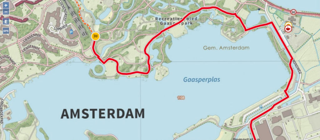
- Or Trekvogelpad 7, which you can take from Metrostation Gaasperplas, returning from NS station Naarden-Bussum.
- Lastly, Zuiderzeepad, starting from Flevoparkweg, and take an alternative route from Muiden to Weesp station following the Vecht river, instead going to the official end Muiderberg.
Leave a Reply